Part of me must be a river rat. (Hi, this is Jim. I’m going to write the blog for the next few days.) Maybe it’s because from the age of about one until we came to Canada, I sailed on the Norfolk Broads in the UK with my family. The Norfolk Broads are an interconnected series of narrow channels, canals, rivers and quiet estuaries. Maybe it goes back to the decade our family lived in Ontario and we boated primarily on small lakes and rivers - the summer of my 16th birthday taking a houseboat down the Trent/Severn waterway. Anyway, something about travelling along a twisty and intricate passageway by boat really appeals to me. One thing’s for sure; it’s the polar opposite of the type of cruising we’ve been doing for the last three years – no ocean swells, no huge distances, no long watches miles off-shore staring at the horizon.
 |
| A new world for Falcon VII. |
Fortunately I’m married to Tricia, my “Amazon Woman” boat partner. She’s always up for a new adventure, so when I proposed we try to take Falcon VII up the Sacramento River all the way to the city of Sacramento, she said with a smile, “Sure, why not?”.
The reason I said “try” is that for the next week or so, everything will revolve around the depth of the water we’ll be in. We’re used to cruising in water averaging hundreds of feet deep and sometimes are in water half a mile or more deep. For much of this trip though, we’ll be in water less than 15 feet deep. Falcon draws 6’9” and we round it off to 7 feet, so this 15 foot average depth means only 8 feet of water under the keel, and if the depth drops to 9 or 10 feet, only 2 or 3 feet between the keel and the bottom.
There are three basic rules to cruising, all the rest is fluff. They are: 1) Be nice to your partner. 2) Keep most of the water outside the boat most of the time. 3) That big 17 thousand pound chunk of lead hanging off the bottom of the boat? Don’t smack it on da rocks. Actually, since we’re in a river delta, there are no rocks on the bottom. It’s all soft silty mud and if we come up against it (let’s not say “hit” it) while we’re going really really slowly we won’t do any damage to our beloved boat. If it weren’t for this last fact, we wouldn’t attempt this trip. When we were in the San Joaquin River in 2013 we nudged the bottom a couple of times with no ill effects.
After our time in the Tulles which Tricia has just written about, this morning at the most civilized time of 0930, we pulled up the anchor and began our 30 mile trip to the town of Rio Vista, from where we would begin our trip up the Sacramento River. Travelling down the San Joaquin River back in the direction we had come from a few days earlier was done under power and it only took a couple of hours to get to the confluence of the San Joaquin and Sacramento Rivers. Even though it was morning, the steady westerly winds were already blowing right against us.
 |
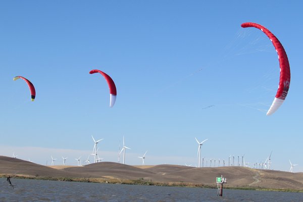
| The winds here are amazingly reliable. |
We took a short-cut across a stretch of water called “Broad Slough”, where we unfurled our “yankee” head-sail and bore away down wind and upstream to the north-east up the Sacramento River.
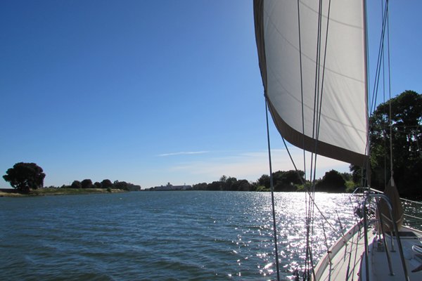 |
| The pace of our lives slows down so much at times like this. |
The winds in this area are one of the reasons I wanted to do this trip. During the spring and summer months, whenever the high pressure cell is here (when it’s sunny, which is virtually all the time) there are almost constant thermally driven winds blowing from the Pacific a hundred miles or more into the Sacramento Valley. The direction is always the same – straight up river, exactly the direction we’re headed. The wind today was a steady 15 knots, slowly building to 20 by late afternoon. Even though we know we’ll pay a price by having to motor all the way back from up-river against the wind, sailing downwind in these conditions is pure pleasure.
We sailed sedately and serenely past a few remnants of the city not too far away; a power plant, an oil terminal and of course the ubiquitous wind turbine generators.
For the most part though, the shore consisted of the levee separating us from the farm land below us. Yes that’s right below us. The whole delta was “tamed” a hundred or more years ago, forever changing the ecosystem which was in place before ‘civilized’ men came to take it over. 1,100 miles of levees were built by Chinese labourers, fresh from building a railroad across the country. These levees created hundreds of tracts of farm land between the channels of water. The rivers too, were ‘tamed’ during this process, concentrating the main channel into a much straighter and extensively dredged version of the original. This made it possible to supply Stockton and Sacramento by paddle-wheeled river boats and to ship gold, lumber, fish and produce from the area to distant ports.
 |
| One of the several bridges we passed under. It always looks like the mast will hit. |
|
| Taxing conditions ..... |
 |
| ......create grueling, hard work. |
Before we knew it, a couple more hours had passed and we reluctantly doused sail and anchored off the town of Rio Vista in the same spot we had a few days ago. The wind blew constantly, building up to about 25 knots late evening before settling down to 10 or 15 for the whole night. Usually, when we’re at anchor, the wind is blowing from the bow as we swing with the direction of the wind. Here though, because of the strong and constantly changing current, we often sat sideways or even stern to the wind – a strange sensation for most sailors.
We spent a few hours after we anchored doing what we have come to do best – lazing around and absorbing our surroundings, then set off to bed with the soft sound of the water chuckling along the hull to put us to sleep.
Friday, June 10th, 2016
This morning Mother Nature insisted that we get up a bit earlier than yesterday and we were out of bed, breakfasted and brushed and ready to haul up the anchor by 0730. I say Mother Nature, because as well as being hyper aware of the depths we’re operating in, we need to be aware of what the currents are doing and to use them to our advantage. Even though there’s only about 4 feet between high and low tide (not much really - northern B.C. and Alaska often have 20 foot tides), as the tide rises the in-flowing water reverses the direction of the river’s flow for many miles inland. So for approximately six hours the water flows down river (the ebb tide) and for approximately six hours it flows up river (the flood tide). We want to be travelling with the flow of the current whenever we’re motoring to save fuel. We also want to be travelling with the flood and it’s rising water levels when we’re operating in shallow water so that just in case we do go aground, the rising tide will take us off as opposed to a falling tide leaving us stranded. We also want to be in shallow water at or near high tide to increase the amount of water under us. All of this tidal information is available in both of our electronic navigation programs as well as in a tide table booklet we picked up in Pittsburg. Every night, I program the next day’s route on our iPad and calculate times and distances and departure and estimated arrival times, hence the alarm going off at 0700 this morning. It’s such a rough life out here.
10 minutes after getting the anchor on board, we were calling the Rio Vista bridge operator on the VHF radio and asking him to stop the busy highway traffic in both directions to let our humble selves pass.
 |
| I'm sure the car drivers are used to it and don't mind one bit. |
Immediately on the other side of the bridge we unfurled half of our yankee, just like yesterday, and headed off up river. After only a mile or two, we came to the junction of the original Sacramento River and the Sacramento Deep Water Ship Canal which runs more or less parallel to the river. It was built years after the river was first dredged to allow for larger ocean going freighters to service the city of Sacramento. From now on, we wouldn’t have to worry about sharing “our” river with these huge ships.
 |
| Everyone shares the water. |
We turned eastward on to a much narrower body of water than we had been on up to now and started to feel the intimacy of scale that we would enjoy for the next few days.
We passed old cottages, mobile homes, big new houses, marinas full of live-aboard houseboats; all kinds of places on the river which people called home. If yesterday’s sailing was pure pleasure, then travelling slowly and steadily under sail along this magical ribbon of water was pure pleasure and then some.


Sometimes as the river took its twists and turns the wind would get fickle for a few minutes and we’d have to finesse the sails to keep Falcon moving, but most of the time we just literally went with the flow. We felt the calming soothing effects of this amazing space immediately and as soon as we came to terms with having only a little water under our keel, we relaxed completely into our life of the moment. There was a road beside the river and the traffic noise was something we had to filter out, but on the other hand, we felt good when we got a few toots of the horn from passing motorists. Sailboats, especially under sail and especially of Falcon’s size, are quite a rare sight for the locals it would seem. We passed under a bascule lift bridge at a town called Isleton and kept on for a few miles more before arriving at the town of Walnut Grove, where we passed under another bridge before tying up at the town dock just in time to go for a lunch out.
Fortunately, part of my planning for this trip had included the provision that wherever we tied up, ice cream would not be too far away. We looked up from the dock to see Mel’s Mocha and Ice Cream just where Google Earth had said it would be.

After a couple of great sandwiches followed by the obligatory cones, we set off to explore town on both sides of the river. In some ways it seemed stuck in the 50’s, very laid-back and obviously running at a pretty slow pace; just our kind of place.

 |
| Looking down from the top of the dike along the river. |
 |
| Looking down on the opposite side. |
 |
| Main Street is from one to five feet below the water level. |
We went back to the boat and after another one of Trish’s great suppers and a bit of reading, hit the sack early, anticipating tomorrow’s travels; hopefully, all the way to Sacramento about 30 miles up the river.
Saturday, June 11th, 2016
The moment I woke up this morning, I knew we wouldn’t be sailing today. The breeze coming in the deck hatch above our bed was coming from the opposite direction it had been yesterday. Since we were tied to a dock and had not swung on our anchor, I could see that it would be on our nose today. I seem to remember saying that the inflow winds, the one’s the locals call the “Delta Winds” blow constantly. Apparently this is not always so. It seems that about 2 percent of the time in the summer, the winds can blow light and fickle and predominantly down the delta instead of up it. Unfortunately, today was part of that 2 percent.
In good spirits regardless, we left Walnut Grove after breakfast, with our trusty motor purring away and puttered along the river with its twists and turns revealing a new vista every few minutes. We slowly passed old, almost decrepit marinas with long term old-timers living on house-boats that haven’t left the docks in years. We passed abandoned or re-purposed giant industrial buildings; canneries, cold storage buildings, grain shipping jetties, all reminding us of times past. We passed yacht clubs and upscale marinas with modest but well kept small cruising boats, none of them sail boats. We passed a huge space-ship shaped water tower and all sorts of flood control structures. We passed small beaches and rope swings tied to branches hanging above the water. We passed fishermen casting from the shore and farmers driving tractors on the levees.
 |
| Classic old-timers, usually lived in by human classic old timers. |
 |
| What might the story behind this abandoned house be? |
 |
| From big to small, everyone gets around by water. |


Most of the time though, we passed miles and miles of steeply sloped levees covered with thousands of oak and other trees, green and lush with early summer growth. Eventually, we stated to glimpse Sacramento’s suburban houses through the trees.


The roof tops were all we could see because of the tall levees on each side of us. As we got closer to the city, the height of the levees increased so that even down-town we could see mostly trees and green from our vantage point on the river. We passed under a couple of fixed bridges and a couple which had to be raised for us. Eventually, we rounded a bend in the river and saw the gold painted “Tower Bridge” in front of us. We had talked on the radio to the staff that runs the city docks and they were there to help us tie up. Our mast was only a few dozen feet from the bridge and we felt the immediate change from being on the river to being downtown in a major American city.

 |
| Our mooring spot was just a few feet out of the bird splatter zone. |


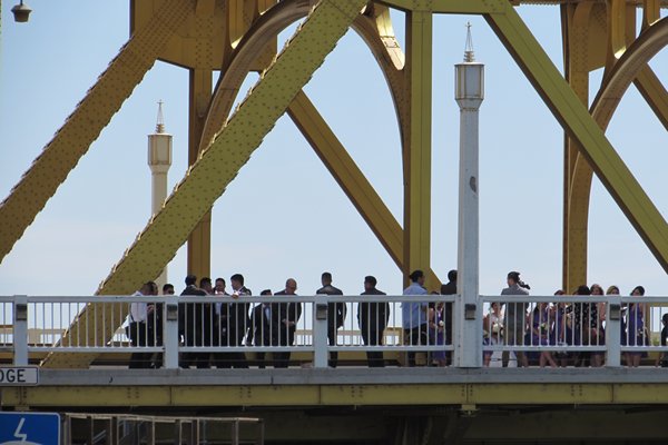 |
| A perfect venue for a wedding. |
 |
| The bridge is almost 100 years old and looks to be in great shape still. |
 |
| Looking from the bridge on our baby. |

By one thirty in the afternoon, the boat was tucked away and we realized that since we were in the middle of the tourist part of town ice cream couldn’t be far away, so off we sauntered in the bright sunlight.
 |
| "Old Town" Sacramento is well preserved and aimed solidly at the tourist trade. |


 |
| This pedestrian tunnel under the freeway connects Old Town to downtown. |
 |
| Its been known to be home to a few crazies. |
 |
| Several large sculptures adorn the downtown zone. |
Sunday, June 12th, 2016 After a fitful sleep due to the heat of the night, we decided a sleep-in was in order, so had a lazy late breakfast while we planned the rest of our day. We had heard of a food and music festival which was to take place today in a beautiful park stretched along the opposite river bank from where we were tied up. We crossed the amazing riveted steel bridge and headed into the shade of hundred year old oak trees while we perused the many ethnic food trucks, people-watched and listened to music.
 |
| The river-front park is well used and well designed. |
 |
| These two great buildings border the park. |

After a great lunch and a quick snooze in the shade on the cool grass, we decided it was time to head into the city. We had already walked around the Old Town section with its dozens of heritage buildings yesterday afternoon, so today we headed in the opposite direction along the beautiful park built on top of the levee, with our eventual destination being the Crocker Art Museum. Once we arrived there, we spent the rest of the afternoon in this most wonderful museum. Along with many galleries of paintings, sculptures, ceramics, textiles and furniture from all over the world, the touring exhibit was over 300 pieces of Andy Warhol’s work. On top of the great art inside, the building itself was interesting – a modern building probably only a decade or so old attached to the original Crocker mansion which had been built over a hundred years ago. It was such a treat to be able to visit such an incredible place. Tricia and I were blown away.
 |
| The museums exhibits were world-class. This is by the glass artist, Chahuli. |


 |
| The Crocker mansion was over the top. |

 |
| Guess the title of this piece. |
 |
| We weren't supposed to take photos in the Warhol exhibit, but Tricia couldn't resist just one. |
Monday, June 13th, 2016
A big part of the reason we had decided to go all the way up to Sacramento was so that we could meet up with four of our cruising friends; Tom and Bobbie and Dan and Deb.
 |
| Good food and good friends, what else can you ask for? |
We had met all but Deb in San Carlos, Mexico and then again in southern California, and had looked forward to seeing them again and meeting Deb. The six of us spent most of today hanging out on Falcon, eating out, seeing the sights and just generally soaking up the peaceful atmosphere of our surroundings. We found Sacramento, or at least the part of it we saw, to be a clean, prosperous feeling and friendly town, comfortable with its place along the banks of the river which gave it its existence. Tomorrow morning we will head down river again to who knows what and who knows when.
Peace,
Jim